
Sunday, 15 December 2013
Creeper plushie
So, this is something i made for my other half for Christmas, but i couldn't resist giving it to her early...

Thursday, 12 December 2013
Converting a Digital Elevation Model into a .ter (YS Flight Terrain Model)
I’m currently doing a Masters Degree in GIS and Conservation, the upshot of that is that I get access to all sorts of cool data… (Though this bit is freely available on the net)
One of my old haunts was the game YSFlight, a free flight simulator. Available from here. I used to make planes and things for this simulator, and occasionally maps. Now I learn how to make maps for a living, and have access to all sorts of mapping resources, so I decided i’d try and mix the two together.
YSFlight uses a file called a .fld file, or field file, for its maps. These files are made up of subcomponants, such as objects and terrains (There are more, but I would be here all day). Now, most of YSFlight is a pretty simple code, the planes use polygons and vectors that if you feel like it, you can modify with notepad…
The field files are the same. One of the componants of the field file is a terrain (.ter) file. Your field file can have many of these .ter files inside it, and these are the bits I’m trying to modify.
So, the terrain file is pretty simple structure wise:
The top of the code looks like this:
TerrMesh
NBL 401 401
TMS 50 50
TerrMesh just says what it is. NBL 401 401 gives the number of rows and columns, so 401 rows and 401 columns. (It can be any number really, and usually they’re much smaller)
TMS gives the sizes of the squares, so 50/50 (Not sure if the units are ft or m, I think m) – So they’re 50x50m square, each cell.
Then comes the data, it begins with “BLO” then the elevation, then… some other details that I dont understand.. Colour is one of the tags following.. For this project though, all I need is the elevation.
Here is one bit:
“BLO 65 R 1 46 112 10 1 46 112 10”
This says that the vertex is 65m up.
So, now comes the good bit… I use a program called ArcMap, its an industry standard piece of GIS software. One of the functions of ArcMap is the ability to export a Raster Digital Elevation Model (Which is basically a picture where darker places mean lower height, lighter places mean higher height) into an ASCII file.
The begining of the ASCII file looks like this:
ncols 401 //Number of Columns
nrows 401 //Number of Rows
xllcenter 460000 //The location of the square
yllcenter 520000 //Also location
cellsize 50 //Size of the cells
Now, with the comments I added, you can see the data contained is very similar to the beginning of the terrain file, contains number of columns, rows and the cell size. The rest of the data is also quite helpful. The rest contains heights separated by a space, for example:
20.0 21.0 21.0 20.0 21.0 21.0 21.0 22.0 22.0 23.0 23.0 23.0 24.0 24.0 24.0
(Thats a pretty flat bit of land) Each new line is a new row in the grid, and each space is a new column.
My coding ability is a bit rubbish… I could’ve probably written a script that simply converted this.. but I’ve no idea where I’d even start, so instead I used notepad++ and excel.
Firstly I opened the ascii file into Excel, it thinks its a CSV file, so I tell it the data is separated by a space, and it makes a nice table where each value is in a different cell, then each row is the length of the number of columns it should be (In my case, 401 columns long, 401 rows high)
I then ran an equation below this selecting the first cell that had the height data in (Cell A6):
="BLO "&A6 &" R 1 46 112 10 1 46 112 10"
This formula takes the value of A6, and adds “BLO “ before, and “ R…etc etc” after the height, so you get a full load of cells with the whole data that the .ter file wants!
I copied this all into notepad++. At the end of each BLO section in the .ter file, after every 401 columns, comes a line which just says “BLO 0.00”, so I did a find and replace, finding the new line marker and replacing it with “BLO 0.00” on a new line. I also did a find and replace as each cell, when copied over, is separated by a tab, so I replaced the tab space with a new line.
This gives the whole middle section of the .ter file, all that remains is to copy it into the .ter, below the TMS 50 50 section, and above the long list of “BLO 0.00” (401 in fact) that ends the file (before the final END).
I ran this for a small section of coastline in the UK, Ordinance Survey Grid Square NZ62, around Saltburn. The data came from the OS’ Panorama DTM.
So, I did all this and created a new .ter file. This i imported into Scenery Editor (From YSFLIGHT.com). The file is huge, 5mb in total, and not really practical for an everyday map being used to fly around in, but it is a technical achievement! Here is the result being flown in YSFLIGHT:

Not hugely impressive I know!
The only real problem, apart from the big file size, is that the image is back to front, North is South…This could quite easily be modified though if it is a common problem that it flips it around.
The data is here: http://www.mediafire.com/download/55u1yxq13l8fxs6/DEMtoYS.zip
If you want it. The OS data is crown copyright, details in that link<
Anyways! Fly safe
-Skipper
Tuesday, 20 August 2013

How the little piggies are coming on
So, before I told you about the little piggies we had on the farm ( ==-Here-== ).
How are they coming on now? Well, they’ve grown pretty big.

Ms Larchfield also pigged 2 weeks later, and now they are all in together.

Wednesday, 31 July 2013
Scything Pt2
So, I started again after lunch, and made some good progress. The farmer from Botton Farm was cutting our Arable Silage field (The one I sowed in may), he finished a very large field in the time it took me to do about 4 rows of my little field… Well, there is a reason behind technological advances…
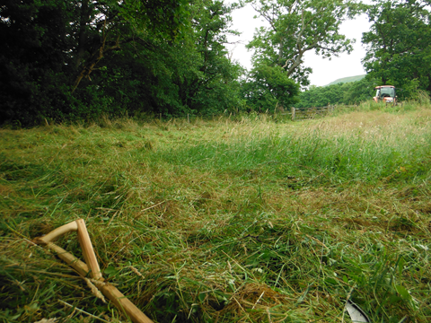
Rain stopped play, so I sat in the tractor for a while, waiting for it to blow over.

It didnt… So I finished the last little bit in the rain.
But at 5pm, I finished my little field:

Yay!
Oh I do love scything!
-Skip

Rain stopped play, so I sat in the tractor for a while, waiting for it to blow over.

It didnt… So I finished the last little bit in the rain.
But at 5pm, I finished my little field:

Yay!
Oh I do love scything!
-Skip
Scything Pt1
So, I’ve started to scythe a field in Botton, here it is before I started:

After 45 minutes of work….

Its gonna be a long day!

My beauty!

After 45 minutes of work….

Its gonna be a long day!

My beauty!
Monday, 15 July 2013
Places to Go in Berlin: Museumsdorfes Düppel
Hello, well, this isn’t usually a tourist information site… But this is one place I want to strongly recommend you go to. (If you’re in Berlin.. Maybe don’t go there just to see this place…)
Here in Yorkshire we’ve got a museum called the Ryedale Folk Museum, it’s basically the local history from Iron Age up to the Victorian period. It’s a nice little museum, quite poshly done, with some interactive displays, some tractors a horse, some goats and some chickens. It’s also worth a visit if you’re up here by the way… But I’ve got side tracked now!
So, I was on holiday in Berlin with my girlfriend this summer, and she recommended a place with an unpronounceable name, (actually it’s quite easy, Museum’s Dorfs Dupple). She’d been there as a child, but not been back for many years, so we decided to give it a go.
What it is:
I’m gonna call it Dupple, it’s easier to remember, and I don’t have the u with the eyes on on my keyboard. Dupple is a reconstruction of a Slavic Village. I’m not going to pretend I know much about the Slavic people, I know they are from the east somewhere, and they came west to Berlin… That’s the extend of what I’ve picked up.
The village is designed around archaeological finds from the area, and the date they’ve gone for is 800 years ago (1200s). Well, on the surface it is your regular medieval village, they have some displays of finds in cases, etc. That didn’t really get me interested that much.
The first thing I found that I absolutely loved was an audio.. thing, what do you call them? You press a button, it tells you something interesting.

This was something on that track, but it was this wooden box ^
There were 2 big holes drilled on the front, labelled “Play” and “Stop.” So, I pressed play, and there was a whirring noise, then it started to tell it’s tale, but it was not some fancy high tech audio device, it was a tape player, and the holes were in line with the play and stop buttons

When it got to the end, it repeated, and you had to press the stop button. It was so primitive, but so effective, I thought it was absolutely great, and very sweet!
The thing I loved about all of the museum is that it is essentially how I would make a museum (If I had those skills…). The Ryedale Folk Museum is very professional, and suffers because of it, everything has a neat little sign on a plate, and is all very official. Dupple has little laminated tags that someone has probably just printed off and laminated themselves. All the “exhibits” are totally hands on.

Well Well Welll
A good example is this well, in the Ryedale Folk Museum, I imagine this would be padlocked so it didn’t move, and behind some sort of fence to stop you touching it. Here you are actively encouraged to use it, no warning about trapping your fingers in it, or a safety fence to prevent you from doing so.
There are often events on at the museum, and the morning of the day we came (We came in the afternoon) they’d been running a workshop on how to make tar from Birch bark, something I’ve since tried to do, and failed miserably at… But it was very hands on, they were using bean cans with a tube stuck in the bottom and collecting the tar in camera film cases.
We saw a green wood turner (Bodgers we call them) and he was very proudly telling everyone watching how he made his tools himself, it was very sweet. Sweet seems to be the key word here…

The museum is very armature, and that is, in this case, definitely not a bad thing. That doesn’t mean that if you’re a serious historian that you may not learn anything, I’m sure you would, but you need to be able to speak German, or have a translator… I was more interested in the practical side of what they were doing, how they were hand forging the sheep shears, how they were trying to recreate ancient breeds of sheep and pig and how they made tar. It is very strongly into Experimental Archaeology, which, besides Dr Daniel Jackson, is the best kind of Archaeology, recreating the techniques used back then.

I’d definitely recommend it, the entrance fee was €2, so really, you can’t go wrong. It is very nicely done, and well, very sweet! I hope it continues for future generations, I’d love to bring my kids there.
Get yourself there and support them, and know that if I had made a museum, it would look just like here!
Getting There
The first issue we actually had was in getting there, so this is what we found:
The best, most direct route we found on the way back it is U3 to Krumme Lanke (It’s at the end of the line, otherwise take the S-Bahn S1 towards Potsdam and get off at Mexikoplatz (The station building is pretty cool looking)

Mexikoplatz S-Bahn Station
From there you are gonna have to hop a bus to get any further. The bus you want is 118, going towards Potsdam. Get off at Clauertstrasse, then head down Clauerstrasse, onto the funny cobblestone road thing until you find the sign!
But here is it on the map:
https://maps.google.co.uk/maps?q=museumsdorf+d%C3%BCppel&um=1&ie=UTF-8&hl=en&sa=N&tab=wl
Subscribe to:
Posts (Atom)